 | |
 | |
 | |
| Established | 2003 |
|---|---|
| Location | 704 South 2nd Street Minneapolis, Minnesota, USA |
| Coordinates | 44°58′46″N 93°15′26″W / 44.97938°N 93.25711°W |
| Type | History Museum |
| Director | David Stevens |
| Public transit access | Bus Routes 3, 7 and 22, METRO Blue Line, METRO Green Line |
| Website | www |
Washburn A Mill Complex | |
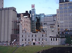
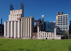
 The Washburn A Mill Complex from the Stone Arch Bridge | |
| Location | 1st St. S. at Portland Ave. Minneapolis |
| Built | 1879 |
| Part of | Saint Anthony Falls Historic District (ID71000438) |
| NRHP reference No. | 83004388 |
| Significant dates | |
| Added to NRHP | May 4, 1983[1] |
| Designated NHL | May 4, 1983[2] |
Mill City Museum is located in the ruins of the Washburn "A" Mill next to Mill Ruins Park on the banks of the Mississippi River in Minneapolis. The museum, an entity of the Minnesota Historical Society that opened in 2003, focuses on the founding and growth of Minneapolis, especially flour milling and the other industries that used hydropower from Saint Anthony Falls. The mill complex that the museum is within, dates from the 1870s and is listed on the National Register of Historic Places. It is also part of the St. Anthony Falls Historic District and within the Mississippi National River and Recreation Area.
- ^ "National Register Information System". National Register of Historic Places. National Park Service. March 15, 2006.
- ^ "Washburn A Mill Complex". National Historic Landmark summary listing. National Park Service. Archived from the original on June 6, 2011. Retrieved November 6, 2007.
© MMXXIII Rich X Search. We shall prevail. All rights reserved. Rich X Search
